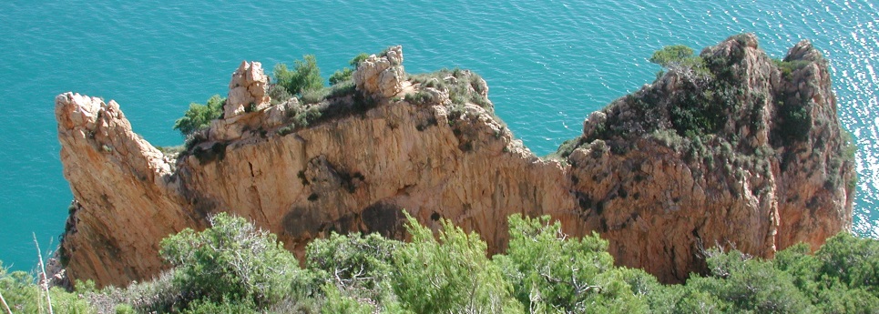
The Moraig Fault, also known as the Riu Blanc Fault, is one of the most spectacular geological features in El Poble Nou de Benitatxell. Located next to Cala del Moraig, it offers an exceptional opportunity to observe the traces left by the major tectonic movements that shaped this stretch of the Mediterranean coastline.
Due to its uniqueness and scientific value, it is recognised as a Site of Geological Interest and was declared a Natural Monument in 2022.
A fracture formed 11 million years ago
The Moraig Fault is a normal fault with vertical displacement, formed approximately 11 million years ago during the Late Miocene.
The movement of large blocks of limestone on either side of the fracture exposed an impressive fault plane, which can now be seen as an almost vertical rock face.
Its surface has a distinctive polished appearance known as a fault mirror. Numerous vertical striations can be observed across it, created by the enormous friction between the rock blocks as they moved. These marks provide evidence of the direction of the movement that formed the fault.
A window into geology
Beside the fault plane is a large opening with seawater visible at its base. Its formation is also directly related to the geological fracture.
The movement of the blocks crushed part of the rock alongside the fault, creating weaker materials that were more vulnerable to erosion. Over time, wave action removed these materials, initially creating a cavity that later collapsed to form the large opening visible today.
At its base lies the outflow lagoon of the Riu del Moraig, or Riu Blanc, connected to the extensive network of underground galleries through which the Benissa aquifer discharges freshwater into the Mediterranean.
A landscape shaped by rock and water
Tectonic activity, the limestone nature of the rock and the continuous action of water have created an extraordinary collection of geological formations around Moraig.
Just a few metres away is La Vasenilla, a spectacular collapse doline with an approximately circular shape and vertical walls. Its evolution helps explain one of the natural processes that can eventually create small coves along this type of limestone coastline.
Also nearby is the Cova dels Arcs, one of the most representative examples of karst and marine erosion along the Benitatxell coastline. The fault, the caves and the Riu Blanc underground system therefore form part of the same geological landscape, created through millions of years of transformation.
Discovering the Moraig Fault
The Moraig Fault Route provides an opportunity to explore this remarkable site and observe some of its most characteristic formations. The route also offers different perspectives of Cala del Moraig and the towering cliffs that define this stretch of coastline.
The Moraig Fault is much more than a spectacular rock face: it is a true window into the geological history of Benitatxell, where the effects of tectonic forces, erosion and water can be observed directly — processes that, over millions of years, have shaped one of the most distinctive landscapes on the Mediterranean coast.